AAG tPoint Mapper is a program written by an Italian amateur astronomer, António Alberto Peres Gomes (AAG) - who has also written several other useful programs, such as AAG Pyxis, AAG Dome, AAG AutoCenter, AAG Cloudwatcher, and AA GWeather Center. Alberto's software development company is AAGWare. This software automates the process of doing tPoint mapping runs. Rather than aiming at specific stars and centering them, as done with manual tPoint mapping, AAG tPoint Mapper points the scope at a grid of az-el coordinates, and does a plate solve at each point. The program knows where the scope should be and knows from the plate solve where the image is actually centered; this data is then fed into the tPoint map. Using AAG tPoint Mapper totally automates the mapping process, saving many hours of labor (but still taking hours of time, for a large map). I find that I can reliably map at least 1 point per minute, and about 2 points per minute maximum. Thus, a 100-point model will take about 2 hours to make, but only about 5 minutes of actual labor time (the program does the rest). AAG tPoint mapper can create grids within certain az-el boundaries, and of nearly any number of points. It integrates with MaximDL; it also integrates with CCDSoft, but for that program there was already a tPoint AutoMapper program available; AAG tPoint Mapper is the only solution for automatic mapping using MaximDL for camera control, to my knowledge. There is a good overview of how to operate AAG tPoint Mapper HERE. There is a short review (and comments) of AAG tPoint Mapper HERE. Operation of AAG tPoint Mapper is very simple. Once started, the program provides a choice of using CCDSoft or MaximDL. The main uniqueness of this program, as far as I'm concerned is it's ability to automatically map points using MaximDL, so this is what I select. You can then go to the Settings tab to select the plate solve parameters, location of the star catalog, and mode of operation. AAG tPoint Mapper can be used to map points, map points with a log (of the errors at each point), or do an analysis of pointing accuracy only. Below, you see the Settings tab: |
 |
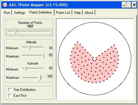
Next, you go to the Points Definition tab to define the range of sky to map - including upper and lower limits for both azimuth and elevation, as well as the number of mapping points to generate. I have the azimuth set from about 45 degrees to 305 degrees, because I have tall trees from 305 to 45 (through North). You can select a large number of mapping points, and then stop the process at any time, but then only a portion of the sky would be mapped. Alternatively, you can map the entire sky with fewer points (e.g., 25-100), and then re-map the sky later (even just an hour later), as there will be different stars at each of the az-el positions, so will add to the tPoint model. Thus, you might want to do a 25-point model to confirm polar alignment, etc., and then when happy, do a 400-point model to fine-tune the pointing accuracy. Below you see the Points Definition tab: |
 |
AAG tPoint Mapper generates a set of mapping points which are evenly distributed in the sky (either evenly by az-el positions - as seen above, or by star distribution, which places points along lines of equal azimuth, as shown below: |
 |
There is also an option to work from East-to-West, or the usual West-to-East. In each case, the scope is targeted at the same or nearby azimuths while it scans the elevations, and then procedes East or West (as selected) and repeats the scan of elevations. In this way, it works itself around the sky in a relatively efficient manner. As the elevations are done together, the dome does not need to rotate (much) until the next azimuth is reached. HOWEVER, I have found that automatic mapping is quite hard on the dome battery (the one that turns the dome); if the battery charge is low or the battery is old, then using an automatic mapping program - where the dome is turned every 30 seconds - may cause the voltage to drop, and the dome to lose its position reference. At least, this is what has happened with my Sirius dome. The dome reports an incorrect azimuth, an needs to be homed in order to be in sync with the telescope again. After replacing the battery, this has not re-occurred. The list of mapping points (sets of azimuth and elevation) is shown on the Points List tab: |
 |
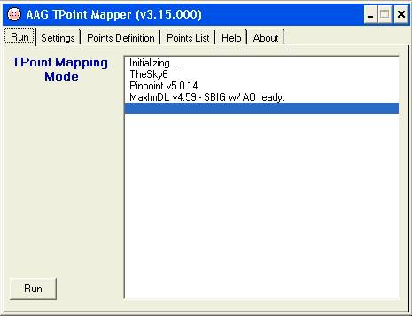
If everything is set, you can then go to the Run tab, and start the mapping process. I show the Run tab below, but this is not during an actual run: |
 |
What happens next is this: 1.) AAG tPoint Mapper slews the telescope to each point 2.) It then uses Pinpoint (full version) to plate solve and find the actual center of the image (i.e., pointing direction of the scope) 3.) It then 'maps' the point in the tPoint model which you have created in TheSky6 Professional 4.) It repeats the process, until all the mapping points have been tried 5.) It then goes back to any points not mapped (perhaps there was a cloud ...), and tries to map these again
After the points are all mapped, you can double-click on the tPoint icon in TheSky, and look at the tPoint model, add terms, and reduce the pointing error as far as possible - as explained on the tPoint page. The great benefit of AAG tPoint Mapper is that it can go through points at the rate of about 2 per minute, allowing mapping of 100 points in under an hour. Contrast this with the 'normal' mapping approach, where you click on a star, slew to that star, take an exposure, re-center the star in MaximDL, and then press the 'Map' icon on the Object Information tab in TheSky. I can't even map one point per minute consistently with the old approach, and it requires me sitting there for an hour or more, while with AAG tPoint Mapper I can have dinner, watch TV, or be working on something else, while the points are mapped. I then get to come in and do the 'fun' part of optimizing the tPoint model. |
|